Sunday, August 19, 2012

Alafia River

We did this trip with the whole family in March.  Put-in at Alderman's Ford and we parked my car downstream.  Hubby and I paddled this river a few weeks prior and took two vehicles but forgot the keys of the car downstream locked inside the truck upstream so several miles down several shoals when we figured it out we had to turn around and try to paddle up shoals.  No easy task!  We made sure we had the keys for the car we had parked downstream.


We had a great time.  The current was not too swift but it was an easy paddle for the boys and they really enjoyed going over the shoals!


Another beautiful Florida river to explore.


Looks like a good place to stop for lunch.


Finally..what kayaking trip on Florida rivers would be complete without seeing a few gators?  Lots of babies piled up sticking out of the water.  Mom was nowhere to be found, thank goodness.


Saturday, August 18, 2012

Arbuckle Creek


Arbuckle Creek was a very enjoyable trip we did a few weeks ago.  True Florida weather this time of the year is quite unpredictable.  Despite the looming clouds, we decided to head out.  The put-in was down a dirt road with residential homes/farms.  One of the residents stopped and asked us if we were lost..I ask my husband to drive slow so I can scope out birds and butterflies to photograph.  We told her we were headed to the Creek and we were also looking at some goats near the road on a farm..they were silly looking with long beards.  The lady told us that they were the fainting kind and would fall over if they heard a loud noise.

There was lots of bird activity at the put-in which was at the end of the dirt road; somebody's house was right on the bank.  Across the street was a barb wire fence swamp enclosure.  I saw a Swallow Tailed  Kite and lots of small birds flying through the grasses.  Was able to get a shot of this White Eyed Vireo.  Also saw a White Peacock (butterfly not bird!).


It did end up raining quite a bit.  There was a nice canopy from the Cypress trees, so we would just pull over and find a little shelter from the rain.  The trees were filled with many sizes and varieties of Tillandsia, or air plants, quite beautiful. 


One side of Arbuckle Creek is part of the Avon Park Bombing Range.  Signs are posted all along the banks, in case you forget.  We paddled to Lake Istokpoga?  I believe it was..underneath a bridge to a landing with a floating dock, large grassy bank and picnic tables.  There was a guard station and we had read on the Internet this was a good place to stop for lunch.  We walked up to the guard station to check and he told us we shouldn't be there..but if we just wanted to eat lunch, we could use one of the tables but go nowhere else!  He said..'This is a bombing range you know?'  (Yes, we did know it was a bombing range before we made this trip.)
 No Florida paddling trip would be complete without seeing at least one gator.  This one was a baby.  There was actually a group of them sitting here, but all were scared off by my inching closer for photos except this one who remained for a couple shots.


This location was remote and beautiful.  With about a half mile left to get back to the put-in, a torrential downpour started.  Unlike the previous sessions that would blow past after a few minutes, the sky was quite black all over and lightning was starting up..which I am quite afraid of while on the water.  We marathon paddled for the last half mile and drenched by the time we got back..kayaks filled with water.  Always bring a change of clothes with you!  Our dry clothes and towels were waiting for us inside the truck.


Thursday, August 16, 2012

Silver River Monkey Kayaking Adventure

Since I am writing about past kayaking trips..I have begun to realize how many details can be forgotten over time.  I kept a manual journal for some adventures and I take pictures practically everywhere I go.  If it weren't for the date feature on my photographs I would likely not even remember when some of these trips took place.  We bought my Eddyline kayak in 10/2011..not even a year now and it has gotten a lot of mileage!  The best I can tell from the dates, the Silver River was the first trip I took in it.  

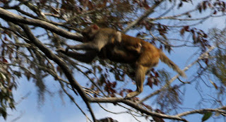
How many monkeys do you spot in this picture?  When I zoomed in, I could find 2.  I wanted to go to Silver River to see the monkeys.  We put in at a park in Ocala..sorry, couldn't tell you what park because I don't remember!  That is why going forward I will post all my trips right after they happen instead of a year later!  We paddled down this river towards the Silver Springs Park..I do remember that.  It was a couple miles of paddling before we spotted the first couple 'posses' of monkeys.  It was hilarious.  They were screeching and carrying on, running up and down the trees..I wanted to get some good pictures but also kept a safe distance from the banks..especially when we spotted the alpha male. 


Admittedly, this trip was quite amazing for me.  I mean, how often do you paddle down a river in the US and look up to see groups of monkeys wandering around, chattering with each other, picking bugs out of their hair, eating, and carrying on about their daily lives.  The Internet holds all kinds of information on these little monkey's origins.  Apparently someone wanted to create a monkey island thinking the monkeys wouldn't swim..many years later.. monkeys now roam wild here.  I believe I read somewhere that biologists are concerned with their presence as they are obviously not part of the native food chain.  
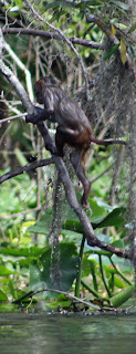
We saw two different groups of monkeys on the water and it was fascinating just to sit in our kayaks and observe them.  The first set of monkeys was actually divided into two groups, one on each side of the river.  They were carrying on at each other and after a few minutes..we noticed several of them running up to the tops of the trees and jumping across the expanse of the river.  This was so entertaining to watch.  As you see from the picture above, a small monkey did not make it across and we watched him to do smack dive into the water from twenty feet up or so.  He was ok and managed to miss the gators..we could've been in for a real National Geographic moment had there been any large ones nearby I suppose.  It was really crazy watching a mom with baby attached to her underside jump across..she made it safely. 
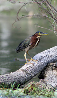


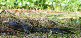
While I did take literally hundreds of monkey pictures, I am an avid nature lover, especially birds, and I managed to capture some other subjects on the river as well.  The gators were relatively small.  The one pictured above in the swampy grass was accompanied by three or four more in the background, all about the same size.  We probably saw a dozen gators or so the length of the trip.  Kayaking in Florida all the time, you lose track of how many gators you have seen on every trip - I can tell you one thing - they aren't endangered in my opinion!

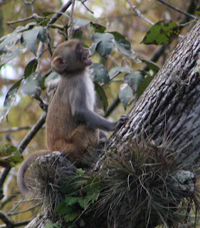


I love the camera my husband bought for me a year ago - a Canon Rebel EOS.  I am just a novice photographer but really enjoy it.  These pictures were taken with my long lens, which has a great zoom but the quality is not as good as my short lens which has image stabilizer.  Also, this was a year ago and I think maybe a year of constantly taking pictures I have gotten a little better.  I initially was never going to take the camera out on the water but I see the most amazing things while kayaking so into a dry bag the camera has gone for every trip since. 


I really hope to have my family visit me one day so I can share this trip with them.  I had pulled a muscle in my shoulder and the trip from the put-in to the Silver Springs attraction and back to the put-in again had me hurting.  I am looking forward to going back one day..maybe we will use a shuttle next time. 


Wednesday, August 15, 2012

Cedar Key and Atsena Otie

The last night of our mini vacation was spent in Cedar Key.  We left Niceville on Saturday morning, just as a line of thunderstorms was headed our way.  We made it to Nature's Landing Condominiums, right on the water and walking distance to restaurants.  After a bite for lunch we decided to paddle out to an island visible from the shore, Atsena Otie.


I was searching for an earthcache I had loaded from geocaching.com.  According to my Garmin, there was supposed to be a cemetery and a trail.  There were actually two islands, split in the middle with oyster coves.  We stopped inside one of the coves to see if we could walk to the spot marked on my gps marked by the cemetery.  It turned out to be inaccessible swampland, and after getting bit by a yellow fly, we headed back to the kayaks to paddle towards the island with the trail.


Nervously, we paddled our kayaks through the interior coves.  We weren't sure if it was low or high tide but the oyster beds were jutting up out of the water in low spots and their razor like scrapes on the bottom of my kayak a couple times made me cringe.  I made it through without too much damage.  We made it through to the beach side of the trail part of the island.  The beach had wildlife boundary signs on it.  On the journey across I had a small shark following me a few times.  My husband said it was scared of me, not following me, but I was scared of it!  I also saw a fight between a Magnificent Frigatebird and a seagull over a fish, they swooped so close to my kayak, they almost touched it.


View right before you enter the woods for the Atsena Otie trail.  We entered the woods next to the beach and walked a few steps down the trail to a kiosk.  As we were reading the sign, I could hear a faint buzzing getting louder and louder.  Looking down at my legs, they were covered in about a hundred mosquitoes!  I took off running down the trail with my gps in hand..I needed to get to the end of the trail to take elevation reading to get credit for the earthcache.  Passed a huge, dead hawk on the trail with feathers spread out all over the place.  Reached an old metal windmill, stopped to catch my breath and glanced backwards at my back, which was exposed due to my bathing suit..I gasped in horror at the massive black swarm of thousands of mosquitoes about to land on me.  I had 250 feet to go to reach the coords on the GPS but I turned around and ran as fast as I could down the trail all the way back to the beach, my husband right behind me.  I was bit many times and we renamed it Blood Donor Island.  Maybe one day I will go back, but only armed with a huge can of DEET.


On Sunday before we left we checked out a couple more trails.  The Cedar Key Railroad Trail, Cemetery Point Park and the Cedar Key Museum State Park.  Armed with bug repellent, each of these trails was a nice diversion.  The Railroad trail is a short walk on a strip of land into the water..you can read about the history on the kiosk at the beginning of the trail.  A geocache is hidden along the trail.  I spotted a Great Southern White and other butterflies while walking.  Cemetery Point Park is a boardwalk in swamp/waterway that borders a cemetery.  There is a geocache located there as well.  Past Cemetery Point Park is the state park.  Trail..filled with mosquitoes..my repellent had worn off in a morning shower.  There is a historical home with a few rooms to view and a small museum are also on the property. 


Tuesday, August 14, 2012

Eglin AFB Boiling Creek and Blackwater River State Park


I was thinking last night about the whole gardening and kayaking blog and realized I do so much of both I need to separate them.  So going forward, I am just putting my kayaking adventures here.  Today, I wanted to start with my most recent mini vacation to the Panhandle area in Florida.  This past week, we made a long twelve hour journey from Central Florida to North Florida.  Now, the drive can be done in about 7.5-8 hours, but we were pulling a pop-up camper, loaded down with two kayaks, and I wanted to go the scenic route.  We drove up 98, forgot to make a turn near Perry and ended up heading towards Tallahassee.  On the outskirts of Tally, we took 27 to 319 and headed south again through Woodville, stopping for lunch in St. Marks.  The drive through Panama City Beach has really changed, Apalachicola, not too much.  I remembered Seaside, but not Watercolor, which we also drove through.
Arriving at Fred Gannon Rocky Bayou State Park, we set up camp in site 24, adjacent to the ranger's private residence road.  The sites were not extremely private, but not too bad.  Checking in, I asked the ranger about kayaking in Puddin' Head Lake.  He laughed and told me it was drained two years ago and was in a restoration process back to its natural state which was just a trickling stream at this point.  I had written a detailed itinerary for our trip with the following day's activities exploring the park's waterways - this hiccup was not a big deal as I figured it would give us more time to explore Blackwater River State Park.  I initially wanted to stay at Blackwater River but their campsites were full when I had made our reservations earlier in the month. The forecast was not favorable for us.  The picture above shows our campsite after one of the many storms we endured.

Eglin Air Force Base  Boiling Creek  

We had to stop at Jackson Guard station to obtain a special pass to be on the base and use it for recreational purposes.  You need your driver's license or ID and you have to watch a safety video.  I learned about UXO - or unexploded ordnances.  So, if you are walking in the woods on a military mission/bombing range and you see bullet casings, bullets, anything that looks like an explosive device - do not pick it up and proceed to smash it with something or throw it in a fire - really??  The nice ladies at the station issued our passes and gave us a huge map of the base.  We had to drive about 40 minutes because of active missions and DO NOT ENTER areas on the map to get to our destination.  They asked us why did we come out this week as it has been raining constantly..  While the storms rolled in, we got in the truck and headed out..passing our turn off road once, the gigantic map was a little bit bulky trying to hold in the cab of the truck.  You would think with a giant map, a car GPS and a handheld GPS we wouldn't get lost.  At last we arrived to our remote spot..which, actually turned out not to be so remote since several people came and went while we were there..they looked like military families enjoying the creek.

We pulled right up to the water

The paddle was enjoyable.  The creek had white, sandy bottoms and mostly clear water - the levels and clarity were altered due to the large amounts of rain but we could still get the idea that it was a clear creek.  It twisted and turned through the land.  We heard bombs going off in the distance for quite some time, as long as it wasn't storming.  Towards the end of the trip, jets were circling above over and over, doing some sort of exercise I imagine.  We paddled for several miles to the confluence of the Yellow River which was wide and moving very quickly.  We went out a little bit onto the river but the current was so fast for me, I turned back to the creek right away while John paddled a little ways up the River to see what was at the next bend.
Waiting out the storm in the truck
We had to paddle under this bridge.  I was worried about the water getting too high and not making it, we had to duck, but we made it.

Alien looking pitcher plants lined the banks
Beautiful Palamedes Swallowtails were flitting along the banks, finally was able to capture one when it landed
Twists and turns, overcast sky

Lily on the bank
Ebony Jewelwing


Blackwater River State Park

On day two, we drove out to Holt, Florida to Blackwater River State Park.  I happened to notice the logs for two of the geocaches I was seeking had not been found in the past year, so I cancelled the quest assuming they were not going to be there.  Went after another one, we did not find near the entrance to the park.  The park was desolate, the ranger was not at the station and not five minutes after arriving at the parking lot to the beach area, an intense storm rolled in.  We waited it out under then pavilions connected by boardwalks near the restrooms.  We checked out the beach and noticed the current of the river was swift like the Yellow River, presumably from all the rain.  I had an outline of about ten geocaches along the river that I wanted to go after but they were located near an upstream bridge.  Since we didn't have a shuttle, we did not want to paddle downstream with such a fast current, then have to paddle back upstream to the truck.  We decided to put in downstream so we could paddle up to the caches, then back down with the current when it was time to turn around.  Using my GPS as a guide, I tried to direct us through the woods to get as close of a put in as I could to the end of the cache trail I had marked.  A primitive campsite led to a 'cliff' that would not do as a put-in.  Eventually, we did find and settle on a put-in that was as close as we could get, about .75 miles from the first cache.  We made it to about .48 miles but John had an emergency at work which he needed cell phone coverage for, so we had to head back to the put-in early.  We enjoyed lunch on the white, sandy bank of one of the beaches.  


Waiting for rain to stop..again


Searching for a good put-in...

Found one!

Nice spot for lunch